VRTOLOM
Vrtolom was forcibly renamed by the Greek Government to Agios Vartolomeos.
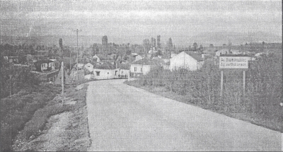
The village is about 10 kilometres east of Lerin. It is on the southern
part of the Pelagonia valley in the fertile Lerin plain. It lies at
21 degrees 32 minutes longitude and 40 degrees 46 minutes latitude.
It is 690 metres above sea level and has an area of about 18 kilometres
squared.
The village borders on the following: to the north-west with the village
Pesochnitsa, to the north with the village Rosen, to the east Banitsa,
to the south Leskovets and to the southwest the village Kuchkoveni.
Before the start of the Greek Civil War about 630 residents lived in
the village and all of them were Madzhiri - Greek immigrants. The villagers
were employed in agriculture and less so with raising livestock and
other necessary occupations. They were employed in agriculture because
of the position of the village in the fertile Lerin plain.
< Return to Index or Next
Chapter >
Lerin in Mourning

