BITUSHA - BITOSHA
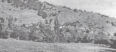
Bitusha had its name forcibly changed to Pararion. It is about 10-11
kilometres to the north of Lerin. It is on the ridge of Baba Mountain
on the periphery of the Pelagonia plain. It is 21 degrees 22 minutes
longitude and 40 degrees 52 minutes latitude and 620 metres above sea
level and has an area of about 6 square kilometres.
The village borders on the following: to the west Rakovo, to the northwest
with the village Opsirino, to the north with Sveta Petka, to the east
Dolno Kleshtino and to the south with Gorno Kleshtino.
In 1945 there were about 560 residents in the village and all of Macedonian
background.
The residents were employed in agriculture, raising livestock, timber
getting and other trades and necessary occupations.
< Return to Index or Next
Chapter >
Lerin in Mourning

