MAALA (MAHALA)
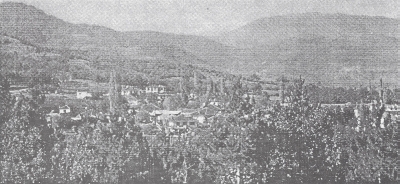
The village of Maala had its name changed by the Greek government to
Tropeuhos. It is about 5 kilometres southeast of Lerin. It is on the
ridge of the Neret mountain on the Lerin Plain at 21 degrees 27 minutes
longitude and 40 degrees 45 minutes latitude and 750 metres above sea
level. Its area is about 9 square kilometres.
The village borders to the northwest with the village Nevoljani and
the town of Lerin, to the northeast with the village Kuchkoveni, to
the east with the village Plishevitsa, to the southeast with the village
Dolno Kotori and to the southwest with the village Krpeshtina. The Grachina
River runs through the village.
Before the start of the Greek Civil War in 1945 about 670 residents
lived in the village, of whom 470 were Macedonians and about 200 Madzhiri-Prosfigi.
The residents were employed in agriculture and raising livestock.
< Return to Index or Next
Chapter >
Lerin in Mourning

